|

Starkey Hill Interpretive Trail Highlights
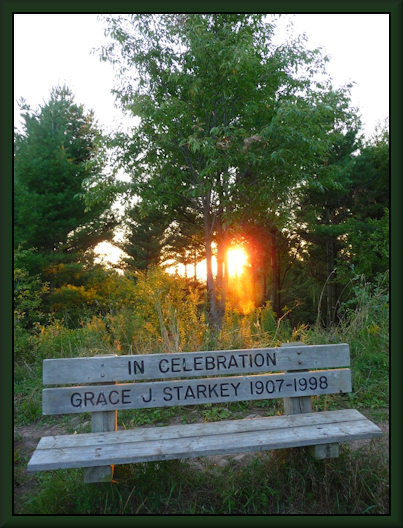
The summit: Our highest pointYou are standing on the highest point in Puslinch Township (383 meters or 1250 feet above sea level). In 1911, a temporary 100-foot wood tower was erected here by the Geodetic Survey of Canada for triangulation surveying. Most of the surveying was done at night when lamps were placed in the tower and sighted from different ground locations. The information gathered formed the basis for topographic mapping. The tower was dismantled in 1920. Today, in its place is a bench in memory of Grace Starkey, wife of one of the former owners of this land.

Former triangulation tower
(courtesy GRCA)
Looking westward, you have a view of the Eramosa Valley and the City of Guelph, with the University of Guelph in the foreground and the twin spires of Church of Our Lady in the background. This ridge is one of few places in the region that offers such an outlook. Unfortunately, the view is constantly being overgrown, requiring a "window" to be cut periodically in the trees. This trimming does not harm the health of Starkey's forests.
View from the summit
(photo Jim Hoare)
The Starkey Hill Interpretive Trail is jointly managed by the Guelph Hiking Trail Club and the Grand River Conservation Authority
Grand River Conservation Authority
Back to Interpretive Trail Map
Guelph Hiking Trail Club is a charitable organization Registration#11894 9395 PO Box 1, Guelph, ON, N1H 6J6 |